Thanks to our friends Bob Beresford and Mark Thompson in the Thames Valley Orienteering Club, we are proud to make available to riders, cyclists, walkers and all users of Hodgemoor Woods a new detailed map (thumbnail on the right).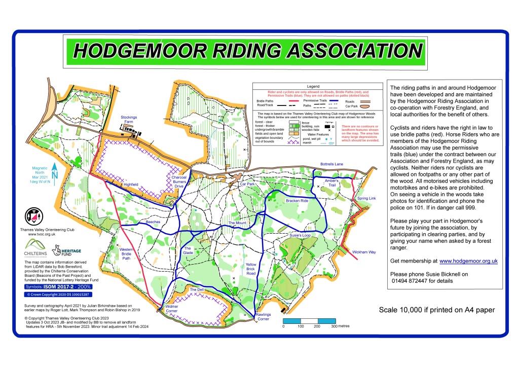
The bridle-paths are shown in red and the permissive horse trails (where cyclists may also ride) are shown in blue. Neither cycling nor horse-riding is permitted on the footpaths (in black) or elsewhere in the woods (Forestry England bye-laws). Roads are in light brown.
 You can download an A4 copy at 830kb at https://hodgemoor.org.uk/wp-content/uploads/2024/02/hodgemoor_map.jpg
This map has a QR code which is used on display posters in the woods and in horse livery yards for users to access on their smart phones. Point you smartphone camera at the QR code, then click on the yellow link which appears towards the bottom of your screen.
We also have a high definition copy at 2.16mb which you can get from us by email; request at chairman@hodgemoor.org.uk